Over 350 students attended the Geospatial Informatics Department’s sixth annual Geo Day held Thursday, March 16 at Troy University. Geo Day gives high school students from around the Wiregrass an inside look into the geospatial industry and an opportunity to gain hands-on knowledge.
Dr. Steve Ramroop, Surveying and Geomatics Sciences Program Director, said Geo Day serves as a great opportunity to introduce the next generation of college students to a growing career field filled with new technology.
“Geo Day is an event where we can showcase geospatial informatics and its diverse use of advanced technologies being applied to our many workflows across many careers/disciplines,” he said. “It’s a time to expose the younger generation to things that interest them such as artificial intelligence, virtual reality, augmented reality and many others; the students always love to see new technologies, which includes some hands-on exercises. We show them how important it is to get a degree in Geospatial Informatics at Troy University, and the high-demand, high-paying jobs that are ready for the taking.”
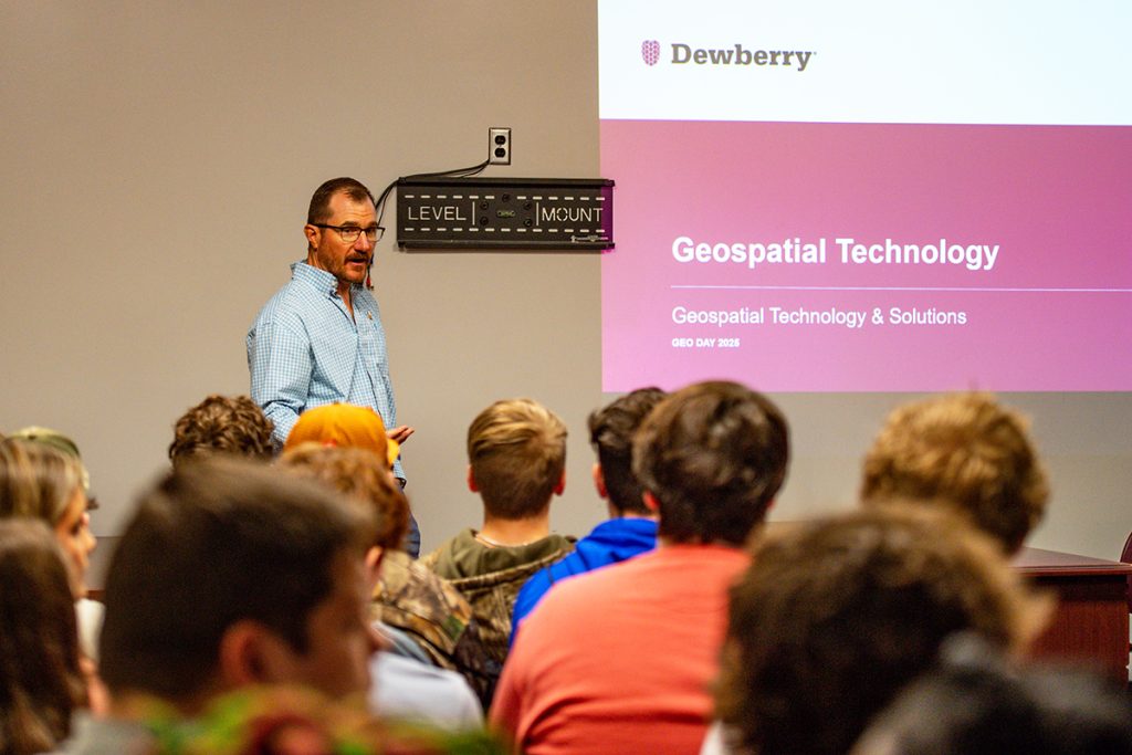
Throughout the day, students had the opportunity to attend workshops and demonstrations hosted by industry professionals, including sessions titled “New Mapping Technologies” from SurvTech, “Modern Surveyor Technology” from the Alabama Society of Professional Land Surveyors,” and “Unmanned Aerial Systems” and a Mobile Mapping Truck demonstration from the Alabama Department of Transportation, plus a session on geospatial informatics programs hosted by TROY faculty and a lesson on geospatial technologies hosted by Dewberry Engineering.
Sharon White, a counselor at Greensboro High School, brought her junior 4-H Tech Changemakers students to Geo Day to introduce them to a career field they may have not heard of before.
“We do a lot of things with technology and even trying to train other community members, so I wanted them to come here and see all the things that TROY offers, and also to see majors they may have not heard of before, especially a lot of careers that are connected to the geospatial industry,” she said. “I learned just as much as they did today, and I feel like I can better guide them on this career path. I hope they understand there are lots of programs out there geared towards the future and technology that will set them up for a successful future.”
O’Brendan Jones, a sophomore from Luverne High School, said he wanted to come to Geo Day to learn about potential opportunities for him post-high school.
“Hearing about all of the career opportunities this field has has definitely opened my eyes and given me the experience that I needed,” he said. “I also got to learn more about TROY and everything else it has to offer; it’s been great.”
Jadin Harris, also a sophomore at Luverne High School, said he didn’t know anything about geospatial informatics, but wanted to learn more.
“I was really curious about what all this was, so I decided to come and find out more,” he said. “I did learn a lot today, and I’m really interested in the drones and the mapping cameras. The experience was great—all of the faculty and speakers were knowledgeable and nice.”
Carson Merritt, a junior geomatics major from Gray, Georgia, served as a volunteer during Geo Day and said the event is an important way to recruit students.
“I know that not a lot of people know about this major, so it’s a good way to get information to them young and have it in the mix when they’re deciding what college they want to go to and what major they want to pursue,” he said. “I think the more people hear about it, the more it will grow because it is such an interesting profession. My experience at TROY has been great so far. The faculty have been more than willing to answer any questions I’ve had and to help however they could. I couldn’t ask for better people to learn from.”
The Department of Geospatial Informatics is home of the Surveying and Geomatics Sciences degree program, the Geographic Information Systems (GIS) major and minor, geography minor, and the Unmanned Aerial Systems (UAS) minor. Employers contact the Geospatial Informatics Department on a regular basis seeking qualified interns and graduates to join their teams.
For more information about the Department of Geospatial Informatics, contact Department Secretary Denise Matthes at dmatthes@troy.edu or 334-808-6727.