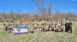
More than 200 high school and college students attended the seventh annual Geo Day at Troy University on March 12 and gained a firsthand look into the geospatial industry.
For the first time since Geo Day began, all of the workshop presenters were TROY alumni.
“To know that our Geospatial Informatics Department taught them, and to then see them use and develop upon this knowledge in order to fulfill a need in the Geospatial industry—and ultimately make a lifetime, rewarding career for the benefit of their family and the community at large—is a good feeling,” said Dr. Steve Ramroop, Surveying and Geomatics Sciences Program Director. “It certainly says that our department is fulfilling one of the many goals, with this one being the ultimate. We are proud of all of our graduates who are excellent ambassadors of the program and department at large.”
The day began at 9 a.m. with an opening session before breaking out into different workshops featuring mapping technologies, modern surveyor technology, unmanned aerial systems and more. Organizations present were the Alabama Department of Transportation (ALDOT), Dewberry Engineering, the Alabama Society of Professional Land Surveyors (ASPLS), Schoel Engineering and PLS Group, Inc.
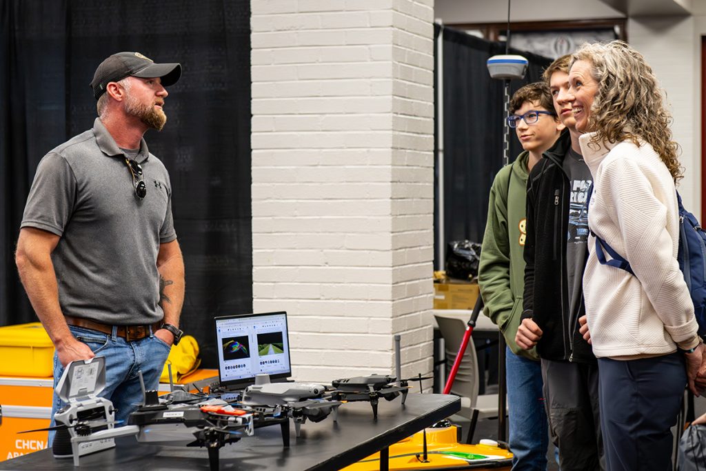
In between workshops, students had the opportunity to interact with different hands-on stations, including: the Sandbox, which allowed students to move sand and see how the technology mapped the elevation through contour lines; the Total Stations, where students can look through the equipment that measures distance and angles; the GIS, which allows students to interact with the maps; and the GIS app, which allowed attendees to input their location and see how the map changes as more people are added. ALDOT also had a selection of drones on display for students to interact with.
“The students learned a lot from these activities,” Ramroop said, “like how to collect data using drones of different brands, costs and sizes, the use of GIS, what a Land Surveyor does when they are in the field collecting data, the purpose of collecting data, for example, to create 3-D models as projected on the Sandbox, and why we need the younger generation to get involved in the Geospatial industry and, in particular, land surveying.”
Justin Hall, a 2022 TROY graduate, is a junior project manager and liDAR specialist at PLS Group, Inc. where he has worked for the last four years. A former Geo Day attendee, Hall said the event played a big role in him choosing his career path.
“When I came to GEO Day I was looking for different career paths and trying to figure out what I wanted to do,” he said. “Looking back now, I’m glad I chose the path I did, and Geo Day had a big impact on that. I’m happy with where I’m at.”
Collin Swanner, a freshman at Brantley High School, said all of the technology was fascinating and he was excited to learn more about the industry.
“This is the first time I’ve ever heard about geomatics or geospatial and I’m very interested in it,” he said. “I’ve always been interested in drones so I knew I would like this, but I learned a lot more about how they use technology to scan landscapes and surrounding areas. I’d like to do that one day. It’s been really cool to be on campus, too.”
The Department of Geospatial Informatics is home of the Surveying and Geomatics Sciences degree program, the Geographic Information Systems (GIS) major and minor, geography minor, and the Unmanned Aerial Systems (UAS) minor. Employers contact the Geospatial Informatics Department on a regular basis seeking qualified interns and graduates to join their teams.
For more information about the Department of Geospatial Informatics, contact Department Secretary Denise Matthes at dmatthes@troy.edu or 334-808-6727.
A gallery of the event can be viewed here.